
In the shadow: Can Greenline overcome sunlight issue in the winter months?
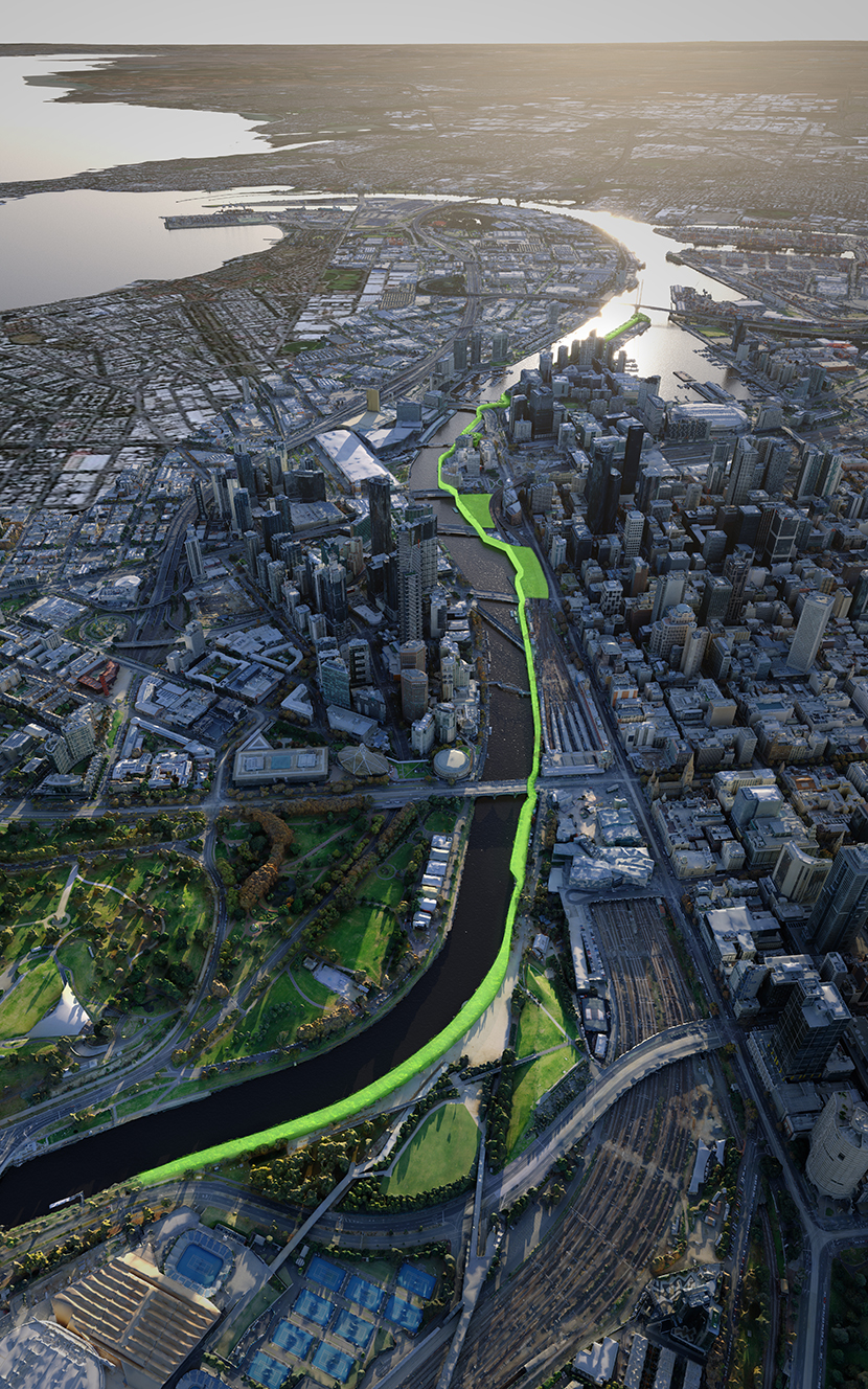
There’s plenty of challenges that the City of Melbourne’s $300 million Greenline project faces before a proposed unveiling in 2028.
The first, and perhaps most obvious challenge for the four-kilometre “city-shaping” trail, is who will fund it.
The council hopes to go “thirds” on the project (that would run from Birrarung Marr to the Bolte Bridge) with upper levels of government; itself funding $100m, with a further $100m each thrown in by state and federal counterparts.
The Council pledged $40m in its latest budget, while the newly-elected federal Labor government committing $20m to kickstart work on the Yarra River north bank pathway.
However, Lord Mayor Sally Capp’s passion project still had a way to go on that front.
Another issue is how Cr Capp and the council might bring together a bevy of authorities along the Yarra River to sign off on different aspects of the large project.
These include the likes of Parks Victoria, Melbourne Water and VicTrack, with the many agencies traditionally making big decisions along the river difficult.
But as Melbourne begins to emerge from the winter months, another issue — albeit non-political — becomes apparent with how Greenline might function on the north bank.
And that is, how the project deals with a distinct lack of sunlight in the winter months.
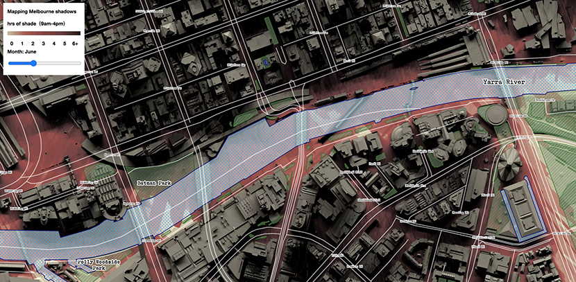
A map that charts shadowing throughout the municipality at different times of the year reveals that some areas along the northern parts of the river receive little to no sunlight in the depths of winter (June).
Which, given the council wishes to make Greenline a year-round trail, emerges as a considerable headache on how it might attract people to the trail during the colder months.
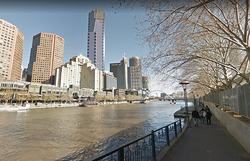
The north bank’s southern sibling, Southbank Promenade, does not face the same problem.
A far greater setback from tall buildings to the north means that the promenade receives far more sunlight than the river’s northern side, even in winter.
It’s this brighter appeal that ensures that, even in the colder months, people are happy to sit and spend time outside along the busy pathway.
Speaking with CBD News recently, Yarra Riverkeeper Charlotte Sterrett said that while the intent of Greenline aligned strongly with the Yarra Riverkeeper Association’s values, overshadowing remained a stumbling block.
“The issue they have with the north bank of the river is the shadow caused by buildings,” she said.
“It’s not going to be as sunny as the south bank ever will be because of the blocking of the sun. We have to think about whether there are ways to increase the sunlight and the amenity of Greenline and people using it. Obviously shading in summer can be great, but in winter you want sun and that passive solar heating.”
Elevating the Greenline trail is the natural way to avoid overshadowing on the path, however early renders of the project suggest that the trail might remain close to the water’s edge.
More detailed plans are expected later this year.
Overshadowing of the north bank is particularly noticeable at the Banana Alley Vaults, and an original draft plan for Greenline noted: “The general presentation of the Northbank is compromised by the elevated rail viaducts which create loud, overshadowed and seemingly leftover spaces”.
The council has acknowledged the challenge of shadowing caused by existing buildings, viaducts and other existing infrastructure and told CBD News it was a “key consideration” for the project’s design development.
It said it was currently working on ways to optimise areas of sun and shade along the north bank to support visitation all year round.
Planning will carefully consider, for example, the locations of new trees, plantings and open spaces in contrast to existing infrastructure – ensuring there are both sunny and shaded areas along the length of the north bank.
The council noted that it was continuing to consult with land owners, developers and stakeholders on the issue. •
Caption 1: A map showing black areas on the north bank of the Yarra River that receive little to no sunlight in winter months.
Caption 2: The sunlight contrast of the north and south bank in winter (Source: Google Maps).
Buy our Journalists a coffee
Support our dedicated journalists with a donation to help us continue delivering high-quality, reliable news

![]()
Related Articles
“Flies in the face”: Council rejects Town Hall tower plan
The City of Melbourne has urged Planning Minister Sonya Kilkenny to reject a major expansion of Lendlease’s Town Hall Station development, warning the proposal would overwhelm one of Melbourne’s most significant civic gateways and cast new shadows over Federation Square and Flinders Street Station.
Read More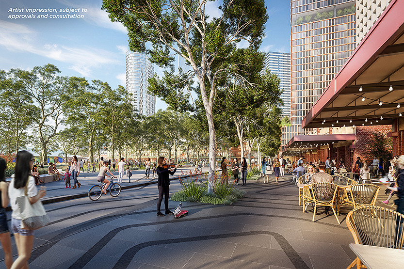
Council backs infrastructure plan as CBD faces space squeeze
The City of Melbourne has endorsed a new 10-year Community Infrastructure Plan, with the CBD identified as one of the municipality’s most constrained areas for future community space.
Read More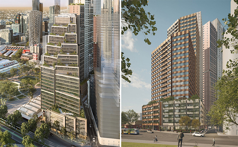
Gurrowa Place redesign approved
City of Melbourne councillors have endorsed revised designs for two towers in Lendlease’s $1.7 billion Gurrowa Place development, following changed market conditions and conditions attached to the project’s federal environment and heritage approval.
Read More
Before we put another tower on Melbourne’s front door, we should ask who gets to decide

New chapter for State Library Victoria

 Download the Latest Edition